9th Grade Expectations:
Prepare for success by knowing these key skills before entering your 9th grade World geography classroom :
1. Know the difference between latitude and longitude
2. Plotting latitude and longitude coordinates
3. Know the location and explain the significance of the equator, tropic lines, polar circles, prime meridian, international date line
4. Read and understand various maps, such as political, physical, thematic maps (climate, resource, mobility, etc.)
5. Know the location of continents and oceans (5 oceans)
Expectations for students next year:
--we emphasize organization, in the form of interactive notebooks or binders.
--improve writing skills, focusing on thesis statements
--interpret primary source documents (DBQ)
--presentation method/skill (facing foward, speaking loudly and clearly, making eye contact with audience)
Just a few helps to prep you for next year...........
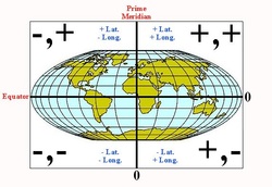
Learn and review how to plot Longitude and Latitude. Click on the map.
Below is the sheet you will have to fill in for the May 8 lab activity. Follow the directions. Username will be given to you in the lab. If you do not finish in the lab, you will have to finish it over the weekend and turn it in on Monday.
Lab Activities
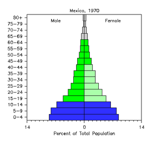
Population Pyramids are used to compare the numbers of male and females in a society, including the ages. Click on the image of the pyramid to watch the video explaining how it works.
1) How would this type of graph be helpful in planning for a population of people?
2) Why do you think it is important to include age for tracking purposes?
3) What can you infer from this population pyramid on Mexico 1970?
1) How would this type of graph be helpful in planning for a population of people?
2) Why do you think it is important to include age for tracking purposes?
3) What can you infer from this population pyramid on Mexico 1970?
Growing pains...................Population changes
|
The population of the earth can fit into the city of Los Angeles if we stood shoulder to shoulder!
What does this mean? |
|
Click on the picture and follow the directions for this interactive map activity. Prepare to complete this activity in the Lab on May 8.

Just click on the image and it will take you to a search engine. Type in any country or location and you will find radio news stories.

Play this game and help feed the world. Free Rice.com was created by a dad as a tutorial to help his son prepare for the SAT exam. It has expanded to include geography, foreign languages and math. As you play, charities and corporations match your winnings in real rice to feed a poor family. Just click on the image to begin.

History pin allows you to go anywhere in the world and compare pictures of historical events to what the location looks like in the present. Information is given on the location and some of the connecting events. Just click on the image and explore the world!
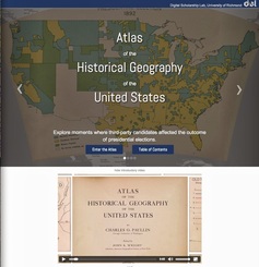
Browse through this online Atlas to see the changes in the U.S. and the world over time. Just click on the image and explore.
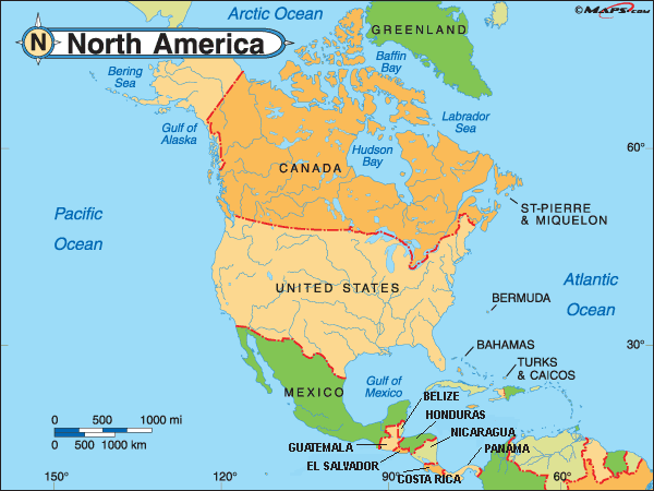
Continents
|
Know.....
the land forms and political boundaries. Discover your home continent and the diversity of cultures living within. |
|
The Panama Canal was completed by the U.S. to create a short cut for transporting goods without having to travel all around the continent of South America. It cut about 7000 miles off trip from the east to the west coast. Watch how they travel through the locks which adjusts the water level from ocean to ocean. It is the only place where oceans meet!
What 2 oceans meet in the Panama Canal? What land feature is Panama located on? |
|
|
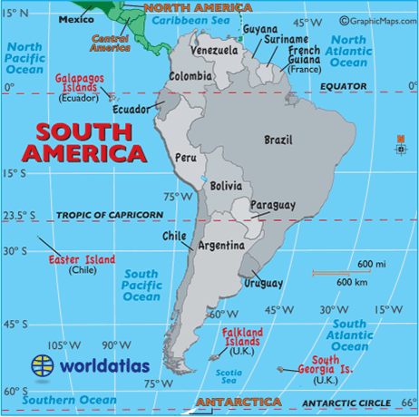
Know:
1. Andes Mountains 2. Grasslands and Plains 3. The Amazon Rain forest 4. Bodies of Water: Amazon, Orinoco River, Rio de la Plata 5. Climate 6. Political boundaries |
|
|
|
Take a tour with Nat Geo.
1. How did some of these places come to be? 2. Were the ancient inhabitants of South America as knowledgeable about civilization as their European counterparts? |
|
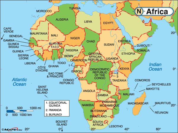
Africa is as diverse as its people. The regions of Africa includes a dry Saharan desert area in North Africa, The Rain forests in Central and West Africa, and the Southern grasslands of the Continent.
Know: 1. Savannas 2. Great Rift Valley 3. Bodies of Water- Niger River, Nile River, Congo River, Zambezi River 4. Lake Tanganyika, Lake Victoria, Lake Nyasa 5. Climate - Arid, hot, warm |
|
Northern Africa is separated from the rest of Africa by the Sahara Desert. The people of this Region are very different from those in the rest of Africa. Try to list all the differences you see.
1. Language 2. Religion 3. Climate 4. Physical Features 5. Culture |
|
|
|
Southern Africa has a treasure trove of wildly famous wildlife------this is where the habitat for animals like lions, elephants, rhinos, Hippos,...etc. It is also the home of the most industrial nation in Africa, "South Africa". Minerals like gold and Copper and a variety of gems like diamonds and emeralds can be found in these parts.
1. How does the wildlife affect everyday life in some of the smaller villages in this region? |
|
Central Africa is the home of the African Rain Forests and one of the most beautiful water falls in the world.
1. As a Traveler in this Region, how can you prepare for a safe and enjoyable trip? 2. What would be 3 things you would need to travel through this region? |
|
|
|
Apartheid crumbles after decades in South Africa.
1. What was the underlying causes of "apartheid"? 2. Who was Nelson Mandela and why is he remembered? |
|
|
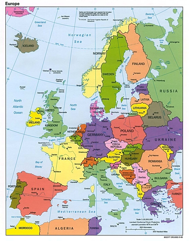
Europe is separated from the Asian Continent by the Ural Mountains, isolating it from the harsher winters of Russia. Countries are smaller and easy to travel through. Europe is one of the smaller continents, but its population is dense. It is a very popular destination for tourism and is historically the origins of most people living in North America.
|
|
Although Europe is smaller, it's rich cultural history boasts some of the most diverse cultures in one continent. Languages such as, English, German, French, Spanish, Portuguese, Italian, Swedish, Finnish, and Greek are the main languages spoken here.
|
|
|
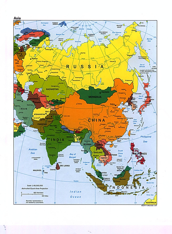
We know Asia is the largest continent on earth, but did you know that more than 1/2 of earth's population lives in Asia?
You can see that Asia is home to a number of different cultures and languages. Its land features include the Himalaya Mountains. China's Great Wall can be seen from Space! Climate regions range from the cold arctic to the deserts of the west and the tropical monsoons of the south. 1. What are the 2 largest populated countries of Asia? 2. Which country has the largest land area? |
|
Desertification in China.......
1) What is causing it? 2) What is being done to reverse it? |
|
|
|
Monsoons are a yearly event in this part of the world.
1. What are monsoons? 2. What are some of the effects of the monsoons? |
|
BREAKING NEWS, current events...........
Russia is invading Ukraine! It has already taken Crimea! What is going on.....Listen as we try to make sense of why leaders in Russia are doing this. |
|
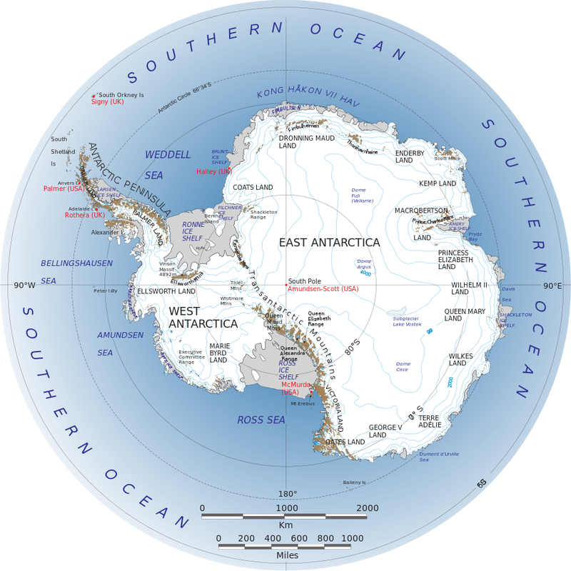
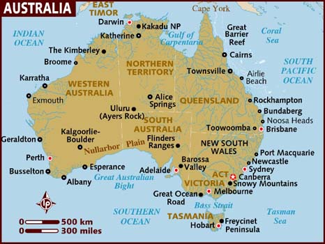
Antarctica & Australia
|
|
|
|
|
|
|
Watch as this 7 year old shares her experience visiting Antarctica! Wow, would you be able to do this? Would you want to. Amazing young woman.
|
|
